| Enduring Understanding | Learning Objective | Essential Knowledge |
|---|---|---|
PSO-4 | PSO-4.A |
|
Political Patterns and Processes
AP Human Geography · Topic 4
 8:12
8:12
Political Patterns and Processes
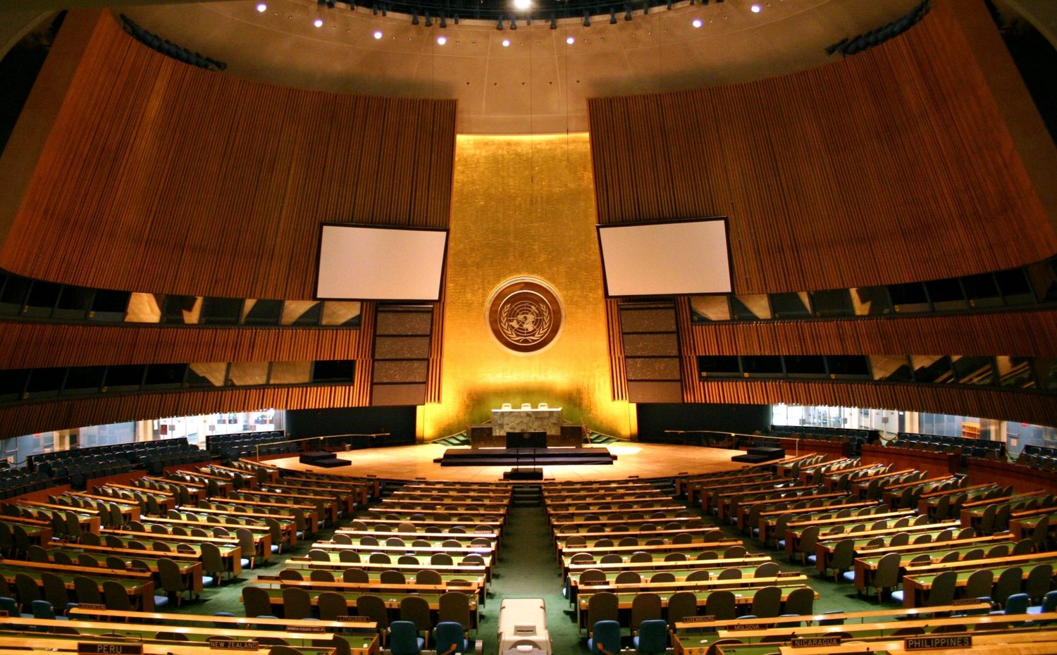
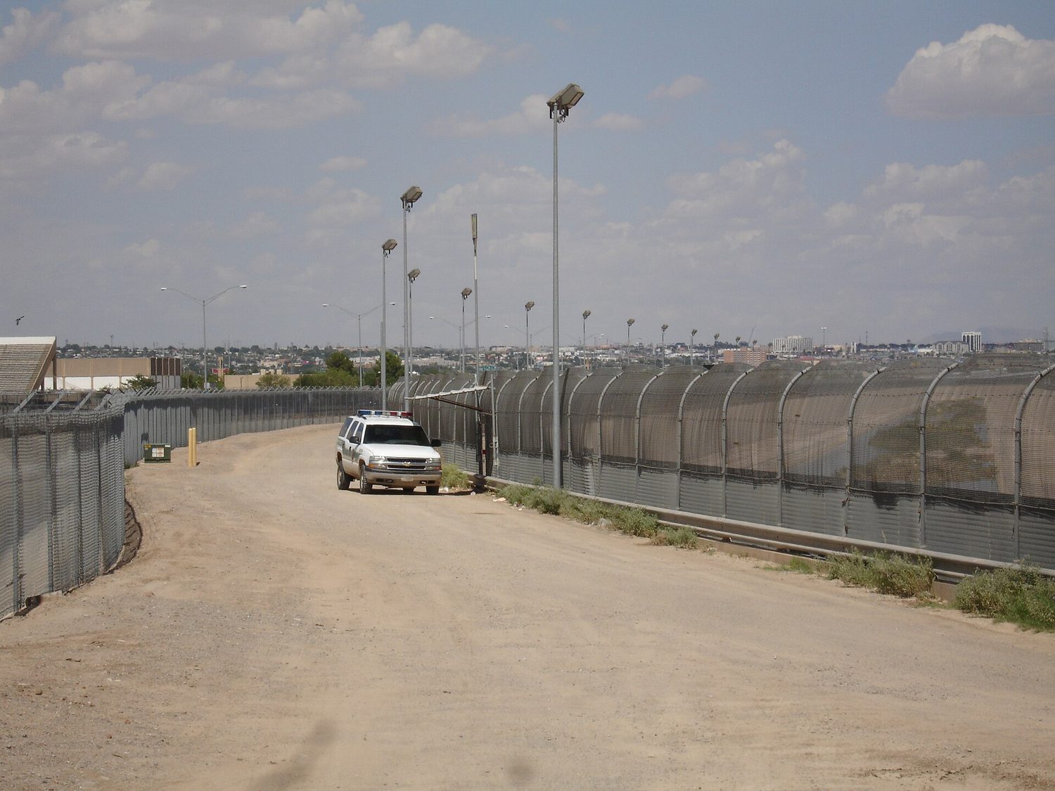
Here is a fence. It runs across open ground all the way to the horizon. On the far side stands a city — the same dry land, the same sky. And here is the hall…
English narration · English + 中文 subtitles burned in
4.1
Introduction to Political Geography
Syllabus
Source: College Board AP Course and Exam Description
Political geography 政治地理学 studies how people organise and control space. A state 国家 is a political unit with territory, a permanent population, a government and sovereignty 主权: authority to govern itself rather than being governed by another state. Borders may be disputed; sovereignty does not mean unlimited practical freedom from treaties or economic pressures.
A nation 民族 is a community with a shared identity, often linked to history, language or culture. It is not identical to citizenship or necessarily one uniform ethnic group. A nation-state 民族国家 describes a close match between a nation's territory and a state's borders. Japan is often taught as an approximation, not a claim that everyone shares one identity: Japan also recognises the indigenous Ainu people.
A multinational state 多民族国家 includes more than one national community. Canada's 2006 parliamentary recognition of the Québécois as a nation within Canada illustrates that nationhood need not mean independent statehood. A stateless nation 无国家民族 lacks an independent state of its own; the Kurds are a commonly taught example. This does not mean all its members lack legal citizenship. A multistate nation 跨国民族 extends across more than one state; it can overlap with stateless nationhood. Autonomous or semiautonomous regions exercise specified self-government within a larger state. Scotland's devolved legislature is an example of powers below the state level, not a separate independent state.
Original classification task. Country A governs its own territory and includes two communities identifying as separate nations. One has an elected regional legislature but no independent foreign policy. Identify the state, the national communities and the regional unit. Check: Country A is a multinational state; national identity and regional self-government do not by themselves establish another sovereign country.
Exam connection — 2025 AP Human Geography, Set 1, Q1(A). The question asks for a definition of an independent state. A possible response is “a political entity with an independent government that governs its own territory.” The official scheme accepts several formulations; it does not require every answer to list recognition, sovereignty and territory as three separate marks. Apply each question's actual command and scheme.
Vocabulary
Train
| English |
|---|
| Political geography/pəˈlɪtɪkl dʒɪˈɒɡrəfi/ |
| state/steɪt/ |
| sovereignty/ˈsɒvərɪnti/ |
| nation/ˈneɪʃn/ |
| nation-state/ˈneɪʃn steɪt/ |
| multinational state/ˌmʌltɪˈnæʃənl steɪt/ |
| stateless nation/ˈsteɪtləs ˈneɪʃn/ |
| multistate nation/ˌmʌltɪˈsteɪt ˈneɪʃn/ |
4.2 4.3
Political Power and Territoriality
Syllabus
| Enduring Understanding | Learning Objective | Essential Knowledge |
|---|---|---|
PSO-4 | PSO-4.B |
|
| Enduring Understanding | Learning Objective | Essential Knowledge |
|---|---|---|
PSO-4 | PSO-4.C |
|
Source: College Board AP Course and Exam Description
Territoriality 领域性 concerns connections between people, culture, economic activity and land, and attempts to influence or control an area. Authority over land can affect resource access, movement and livelihoods. Self-determination 自决 means a people's ability to determine its political status; it does not make every national community an independent state automatically.
Colonialism involves external control of territory and people, sometimes with settlement. Imperialism is the wider extension of power over other societies. Independence movements and negotiated changes can alter political boundaries. Neocolonialism 新殖民主义 describes continuing unequal influence, especially economic influence, after formal independence; foreign trade or investment alone does not prove it.
Choke points 咽喉要道 are narrow strategic passages, such as the Suez Canal or Strait of Malacca. Disruption can increase shipping costs and give particular routes strategic importance. Geography does not establish unrestricted legal control over all passing ships. Shatterbelts 破碎地带 are regions where internal divisions interact with competition between external powers; conflict is not an inevitable consequence of ethnic diversity.
Original explanation task. Country B depends on one overseas buyer for most export revenue. Explain how this could constrain policy without formal foreign government of its territory. Check: a threat to withdraw purchases may put pressure on domestic decisions. To establish neocolonial influence, investigate unequal bargaining power and actual control, not merely the existence of trade.
Vocabulary
Train
| English |
|---|
| Territoriality/ˌterɪˌtɔːrɪˈælɪti/ |
| neocolonialism/ˈniːəʊkɒləʊnɪəlɪzəm/ |
| Choke points/tʃəʊk pɔɪnts/ |
| shatterbelts/ˈʃætəbelts/ |
| Self-determination/self dɪˌtɜːmɪˈneɪʃn/ |
4.4 4.5 4.6
Political Boundaries

Syllabus
| Enduring Understanding | Learning Objective | Essential Knowledge |
|---|---|---|
IMP-4 | IMP-4.A |
|
| Enduring Understanding | Learning Objective | Essential Knowledge |
|---|---|---|
IMP-4 | IMP-4.B |
|
| Enduring Understanding | Learning Objective | Essential Knowledge |
|---|---|---|
IMP-4 | IMP-4.B |
|
Source: College Board AP Course and Exam Description
A boundary 边界 marks a territorial division, internationally or within a state. Classify its history separately from its shape or current function.
- Antecedent 先成边界 boundaries precede the later development of the cultural landscape or intensive settlement. “Before settlement” must not imply that Indigenous inhabitants were absent.
- Subsequent 后成边界 boundaries develop after settlement and cultural landscapes. Consequent 随成边界 boundaries are drawn to reflect divisions such as language or religion; they are often treated as a kind of subsequent boundary.
- Superimposed 叠加边界 boundaries are imposed with little regard for existing cultural patterns, often by an external power. They need not be straight.
- Relic 残余边界 (also “relict”) boundaries no longer function politically but remain evident in landscapes or patterns, as with surviving traces of the Berlin Wall.
- Geometric 几何边界 boundaries follow straight lines or geometric rules. Their geometry alone does not establish when, why or by whom they were created.
Original classification task. A treaty draws a straight line across two existing language communities without consulting them. Later the border disappears, but old checkpoints remain. At creation it is geometric and superimposed; later its traces are relict. These labels answer different questions and can overlap.
Boundary establishment has related activities: definition agrees the wording; delimitation maps the line; demarcation marks it physically; administration manages crossings and enforcement. A legal boundary need not have a continuous fence. Disputes can concern the wording (definitional), the line's position (locational), crossing rules (operational) or resources (allocational). A resource extending across a border can produce competing claims even where the line itself is agreed.
Political agreements can also establish buffer areas and rules for territorial claims. The 1953 Korean Armistice established a military demarcation line and a demilitarized zone separating opposing forces; a buffer zone is not simply another name for every international boundary. The 1884–1885 Berlin Conference established rules for colonial claims in Africa. It must not be described as one meeting drawing every modern African border. These examples illustrate different political processes, not one universal boundary history.
Original dispute task. Two states agree on a river boundary but disagree over shared irrigation withdrawals. Identify the main issue and explain a mechanism. Check: this is principally allocational: upstream withdrawal can reduce downstream supply. It is not necessarily a failed attempt to mark the boundary.
The UN Convention on the Law of the Sea (UNCLOS) 联合国海洋法公约 distinguishes maritime rights. A territorial sea can extend up to 12 nautical miles from the relevant baseline; sovereignty there is subject to passage rules. An exclusive economic zone (EEZ) 专属经济区 can extend up to 200 nautical miles from the baseline and gives specified resource rights, not complete sovereignty over all movement. Other states retain navigation and overflight freedoms under the Convention. Facing or adjacent coasts can produce overlapping claims requiring delimitation; neither distance is an automatic exclusive entitlement regardless of neighbours.
The shape of a state can influence travel and communication, but does not determine governance quality.
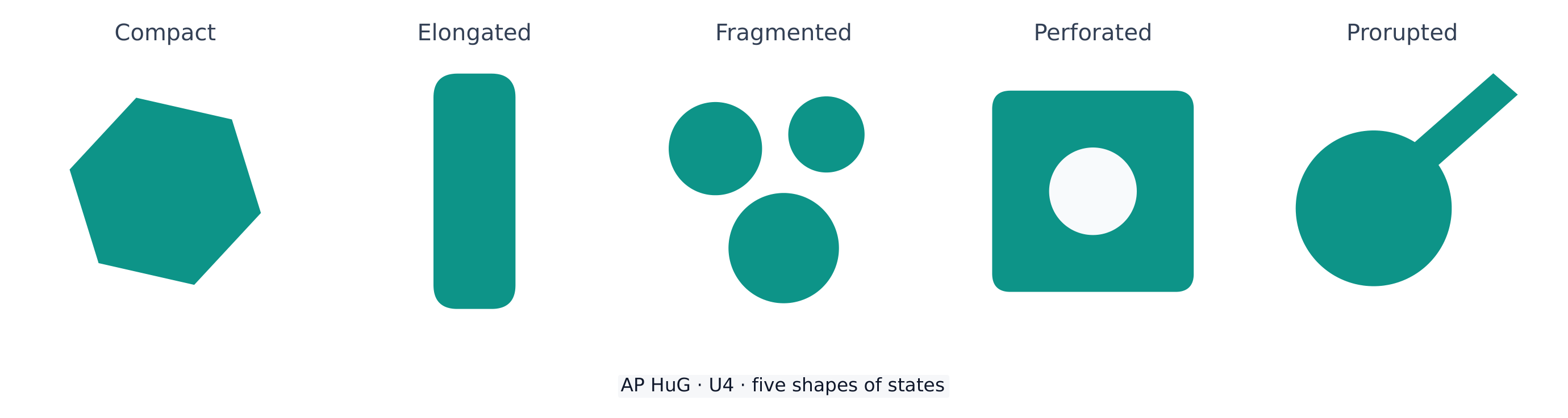
Compact means relatively concentrated; elongated means long and narrow; fragmented means separated parts; perforated means surrounding another state; prorupted means a projecting extension. An elongated state may face long travel distances, while a fragmented state may depend on sea or air links. A compact state can still have poor access if mountains or weak infrastructure interrupt routes.
Internal boundaries and voting
Internal boundaries organise jurisdictions, services, representation and data collection. Redistricting 重新划分选区 redraws electoral districts. Gerrymandering 选区划分不公 manipulates district boundaries to advantage a political group; not every redistricting is gerrymandering. Packing 集中选民 concentrates opponents in fewer districts; cracking 分散选民 splits them among districts where they are outvoted.
Original voting model. Twenty adjacent cells form a four-row, five-column town. Each cell contains one voter. Every row reads A, A, A, B, B. There are 12 A voters and 8 B voters. Make four contiguous districts of five voters each, with one seat per district and simple majority voting.
Plan R uses each complete row as one district: A wins all four seats. Plan P uses the following district numbers, with the voters unchanged:
| Row | Cell 1 | Cell 2 | Cell 3 | Cell 4 | Cell 5 |
|---|---|---|---|---|---|
| 1 | 1 | 1 | 3 | 3 | 3 |
| 2 | 1 | 1 | 1 | 3 | 3 |
| 3 | 2 | 2 | 2 | 4 | 4 |
| 4 | 2 | 2 | 4 | 4 | 4 |
Try it: count each party in every district before checking. Worked check: Plan P packs A into districts 1 and 2 (5 A each), while districts 3 and 4 each contain 1 A and 4 B. A receives 60% of votes but only two of four seats under P, compared with four under R. The original model isolates boundary effects: all voters participate and all districts are equal and contiguous. Real evaluations also require evidence about intent, legal criteria and the geography of voters; unequal vote and seat shares alone do not prove unlawful manipulation.
Vocabulary
Train
| English |
|---|
| boundary/ˈbaʊndəri/ |
| Antecedent/ˌæntɪˈsiːdənt/ |
| subsequent/ˈsʌbsɪkwənt/ |
| superimposed/ˌsuːpərɪmˈpəʊzd/ |
| relic/ˈrelɪk/ |
| UN Convention on the Law of the Sea (UNCLOS) |
| exclusive economic zone (EEZ)/eksˈkluːsɪv ˌiːkəˈnɒmɪk zəʊn/ |
| Gerrymandering/ˈdʒerɪmændərɪŋ/ |
| Consequent/ˈkɒnsɪkwənt/ |
| Geometric/ˌdʒiːəʊˈmetrɪk/ |
| Redistricting/ˌriːˈdɪstrɪktɪŋ/ |
| Packing/ˈpækɪŋ/ |
| cracking/ˈkrækɪŋ/ |
4.7
Forms of Governance

Syllabus
| Enduring Understanding | Learning Objective | Essential Knowledge |
|---|---|---|
IMP-4 | IMP-4.C |
|
IMP-4.D |
|
Source: College Board AP Course and Exam Description
A unitary state 单一制国家 has ultimate authority concentrated nationally; regional bodies can still exercise delegated or devolved powers. A federal state 联邦制国家 constitutionally divides powers between national and regional governments. Canada's federal and provincial legislatures have assigned powers; the United Kingdom illustrates devolution within a system where Parliament retains legislative supremacy. Federal and unitary describe the territorial organisation of authority, not whether a state is democratic.
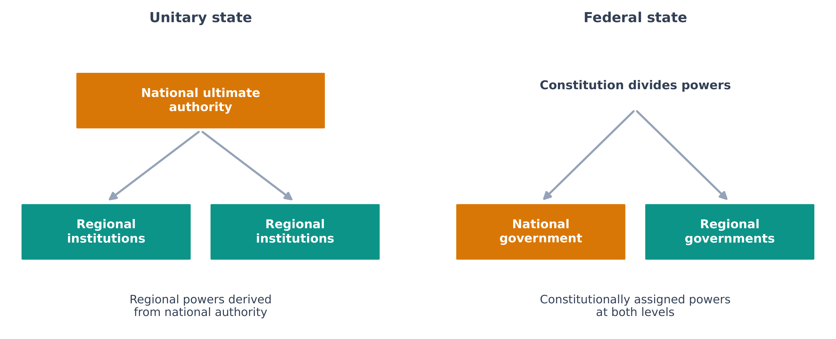
Original comparison. In State U, the national legislature can alter powers delegated to provincial offices. In State F, a constitution assigns regional legislatures authority over specified policy areas. Both have regional capitals. Identify the arrangements and explain a spatial consequence. Check: U is unitary and F federal. In F, regional capitals can become policy-making centres, allowing some local variation. Federalism can accommodate diversity but may also complicate coordination; neither arrangement automatically suits one size or culture.
Vocabulary
Train
| English |
|---|
| unitary state/ˈjuːnɪtəri steɪt/ |
| federal state/ˈfedərəl steɪt/ |
4.8 4.9
Devolution and Challenges to Sovereignty
Syllabus
| Enduring Understanding | Learning Objective | Essential Knowledge |
|---|---|---|
SPS-4 | SPS-4.A |
|
| Enduring Understanding | Learning Objective | Essential Knowledge |
|---|---|---|
SPS-4 | SPS-4.B |
|
Source: College Board AP Course and Exam Description
Devolution 权力下放 transfers or disperses power from the centre to subnational units. In broad AP usage, it also covers fragmentation that can end in state disintegration. Autonomy 自治 is a degree of self-government; it is not identical to independence. Devolution can respond to regional demands and sometimes maintain a state rather than destroy it.
Physical separation, economic inequality, ethnic separatism and political exclusion can encourage demands for regional power. Irredentism 领土收复主义 seeks to incorporate territory in another state on grounds such as shared national identity. Ethnic cleansing forcibly removes a group from an area; terrorism uses violence or threats for political purposes. These can destabilise territorial control, but regional differences and violent acts do not mechanically produce devolution. Explain the actors, demands and government response.
Supranational organisations 超国家组织 coordinate action above the state scale, for example on trade, security or environmental problems. The AP framework groups the EU, UN, NATO, ASEAN, African Union and Arctic Council here, although their decision powers differ. Common rules can limit individual member choices while helping states achieve shared aims. UN General Assembly recommendations must not be treated as identical to binding Security Council decisions or EU rules in transferred policy areas.
Communication technology can help movements organise across regions or borders and help institutions monitor agreements. It can also strengthen state monitoring and coordination. States can regulate networks and capital flows; “the internet crosses every border freely” is not a reliable rule.
Original sovereignty task. States agree to a common river-pollution standard and joint monitoring. Explain a benefit and a limit on national action. Check: shared monitoring can reduce pollution spilling across borders, but each member's freedom to choose weaker standards is constrained by its commitment. The effect depends on the agreement and enforcement, not simply membership in any organisation.
Vocabulary
Train
| English |
|---|
| Devolution/dɪvəˈluːʃn/ |
| autonomy/ɔːˈtɒnəmi/ |
| supranational organisations/ˌsuːprəˈnæʃənl ˌɔːɡənaɪˈzeɪʃnz/ |
| Irredentism/ɪˌriːˈdentɪzəm/ |
4.10
Centrifugal and Centripetal Forces

Syllabus
| Enduring Understanding | Learning Objective | Essential Knowledge |
|---|---|---|
SPS-4 | SPS-4.C |
|
Source: College Board AP Course and Exam Description
Centrifugal forces 离心力 weaken cohesion at a specified scale. Unequal public investment or exclusion can produce resentment and separatist demands. Severe losses of authority and services can contribute to what textbooks call failed states 失败国家; this is a broad description, not a single inevitable outcome or a neutral measure without criteria.
Centripetal forces 向心力 strengthen cohesion, for example inclusive institutions, equitable infrastructure and shared civic symbols. Ethnonationalism 族裔民族主义 links nationhood to ethnic identity. It can unite an ethnic community while excluding others or weakening wider state cohesion. There is no universally strongest force independent of context.
Original scale task. A new rail network connects previously underserved regions; a national language policy gives services only in one group's language. Explain why one may build cohesion and the other may have different effects across groups. Check: improved access can reduce isolation and inequality; an exclusive language rule can strengthen one group's identity but alienate others. Examine participation and access rather than classifying every language policy or national symbol as automatically unifying.
Explore
Centrifugal or centripetal force?
A centrifugal force pulls a state apart; a centripetal force holds it together.
Vocabulary
Train
| English |
|---|
| Centrifugal forces/ˌsentrɪˈfjuːɡl ˈfɔːsɪz/ |
| failed states/feɪld steɪts/ |
| Centripetal forces/senˈtrɪpɪtl ˈfɔːsɪz/ |
| ethnonationalism/ˌeθnəˈneɪʃənəlɪzəm/ |
4.10
Exam tips
Define the entity and scale. Classify boundary history, geometry and function separately. Compare governance using constitutional powers. Explain who is affected, using a mechanism supported by evidence; one feature alone cannot establish conflict, independence or unity.
Interactive lessons on this topic
Work through it step by step, with instant-check exercises.
- Introduction to Political Geography
- Political Processes
- Political Power and Territoriality
- Defining Political Boundaries
- The Function of Political Boundaries
- Internal Boundaries
- Forms of Governance
- Defining Devolutionary Factors
- Challenges to Sovereignty
- Consequences of Centrifugal and Centripetal Forces