| Enduring Understanding | Learning Objective | Essential Knowledge |
|---|---|---|
ERT-4 | ERT-4.A |
|
Earth Systems and Resources
AP Environmental Science · Topic 4
 7:28
7:28
Earth Systems and Resources
Two towns, forty kilometres apart, on opposite sides of one mountain range. One of them gets three metres of rain a year — a rainforest. The other gets less…
English narration · English + 中文 subtitles burned in
4.1
Plate Tectonics
Syllabus
Source: College Board AP Course and Exam Description
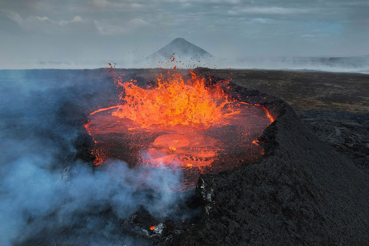
Earth's crust is broken into plates 板块 that slowly move on the mantle – plate tectonics 板块构造. At divergent boundaries plates spread apart (new crust); at convergent they collide (mountains, volcanoes, earthquakes); at transform they slide past (earthquakes). Boundaries create hazards but also volcanic soils and mineral resources.
Vocabulary
Train
| English |
|---|
| plates/pleɪts/ |
| plate tectonics/pleɪt tekˈtɒnɪks/ |
4.2
Soil Formation and Erosion
Syllabus
| Enduring Understanding | Learning Objective | Essential Knowledge |
|---|---|---|
ERT-4 | ERT-4.B |
|
Source: College Board AP Course and Exam Description
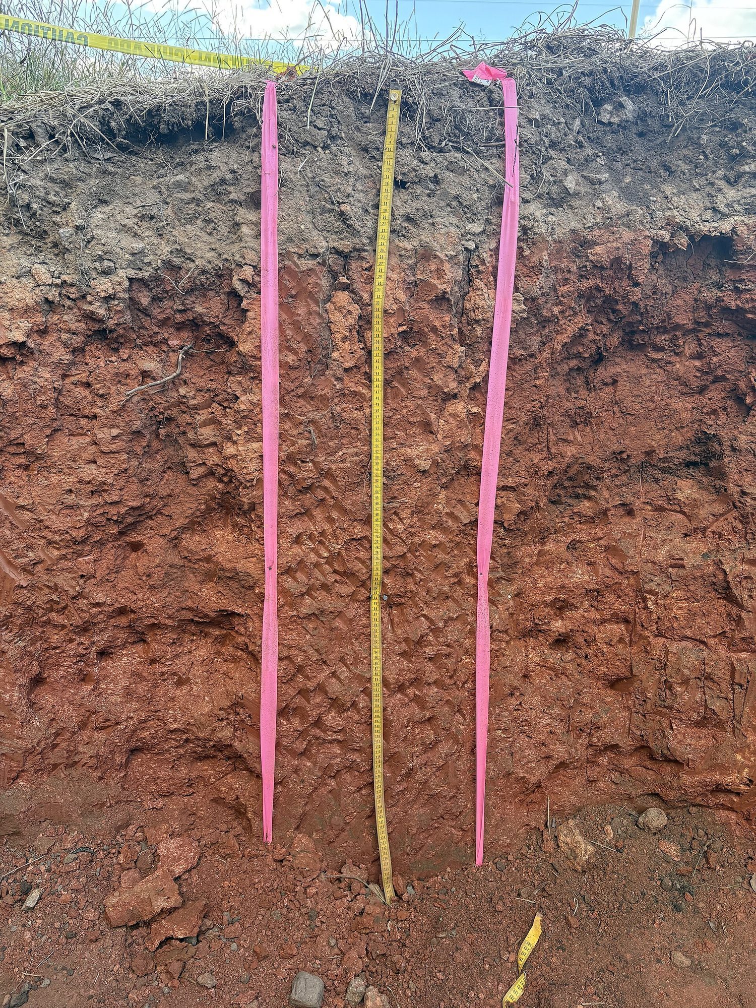
Soil 土壤 forms slowly as rock weathers 风化 and organic matter builds up. Erosion 侵蚀 is the removal of soil by wind and water, sped up by removing vegetation (farming, deforestation, overgrazing). Because soil forms so slowly, erosion faster than formation depletes a vital resource.
Vocabulary
Train
| English |
|---|
| Soil/sɔɪl/ |
| weathers/ˈweðəz/ |
| Erosion/ɪˈrəʊʒn/ |
4.3
Soil Composition and Properties
Syllabus
| Enduring Understanding | Learning Objective | Essential Knowledge |
|---|---|---|
ERT-4 | ERT-4.C |
|
Source: College Board AP Course and Exam Description
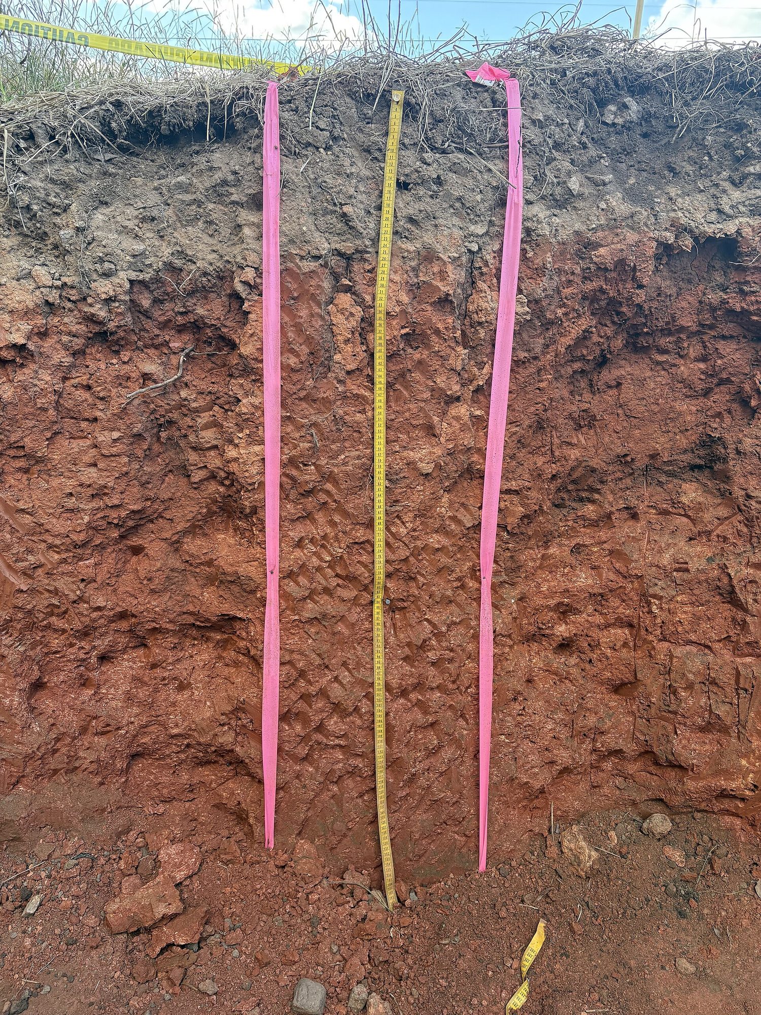
Soil is a mix of sand, silt, and clay (its texture 质地), plus organic matter, water, and air, layered in horizons 土层. Texture controls porosity 孔隙度 and permeability 渗透性 – how well soil holds water and nutrients. Loam (a balanced mix) is best for plants.
Vocabulary
Train
| English |
|---|
| texture/ˈtekstʃə/ |
| horizons/həˈraɪznz/ |
| porosity/pɔːˈrɒsɪti/ |
| permeability/ˌpɜːməˈbɪlɪti/ |
4.4
Earth's Atmosphere
Syllabus
| Enduring Understanding | Learning Objective | Essential Knowledge |
|---|---|---|
ERT-4 | ERT-4.D |
|
Source: College Board AP Course and Exam Description
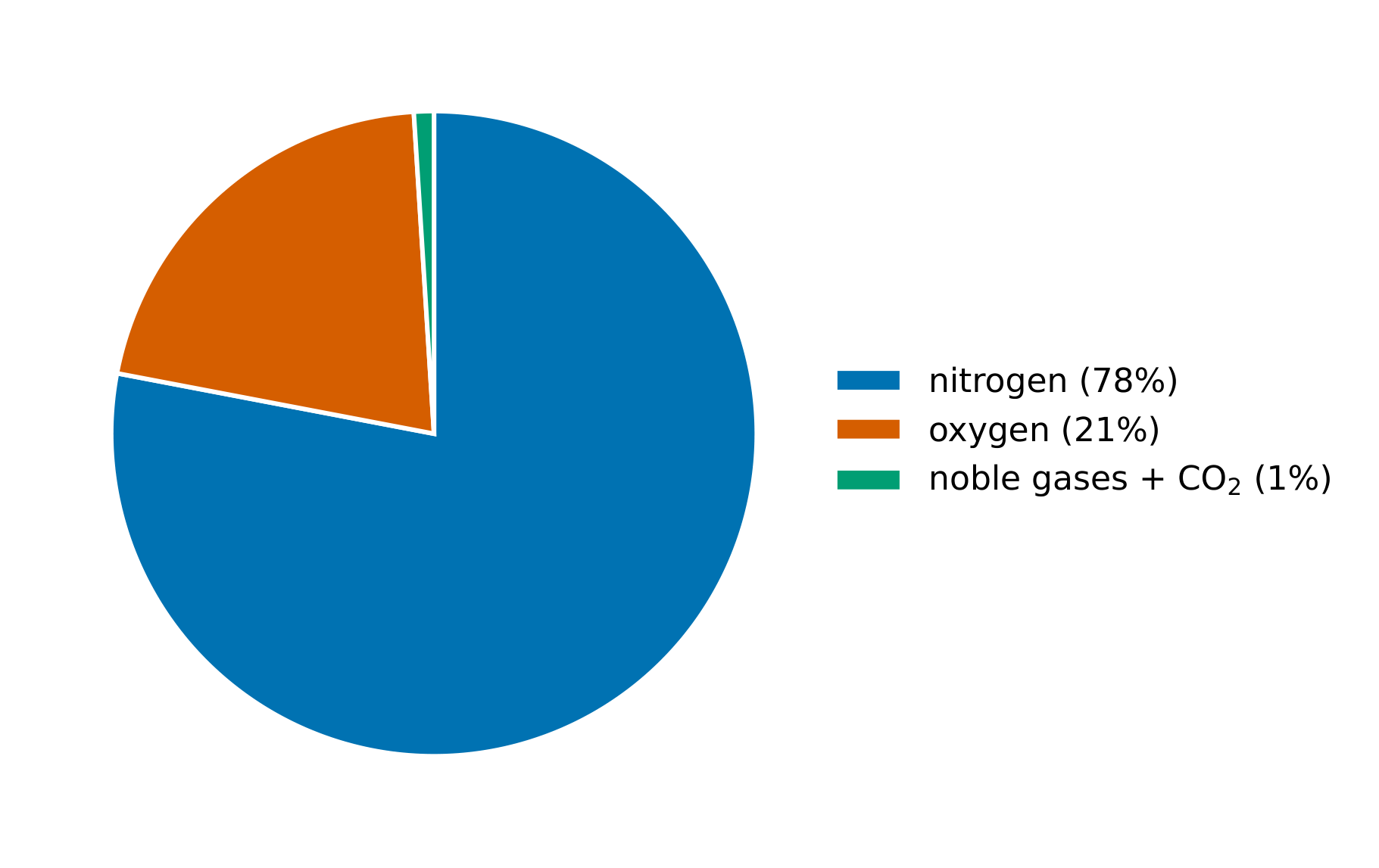
The atmosphere 大气层 is layered: the troposphere 对流层 (weather, where we live), the stratosphere 平流层 (holding the ozone layer), and higher layers. It is mostly nitrogen and oxygen, with trace gases (including greenhouse gases) that regulate temperature.
Vocabulary
Train
| English |
|---|
| atmosphere/ˈætməsfɪə/ |
| troposphere/ˈtrɒpəsfɪə/ |
| stratosphere/ˈstrætəsfɪə/ |
4.5
Global Wind Patterns
Syllabus
| Enduring Understanding | Learning Objective | Essential Knowledge |
|---|---|---|
ERT-4 | ERT-4.E |
|
Source: College Board AP Course and Exam Description
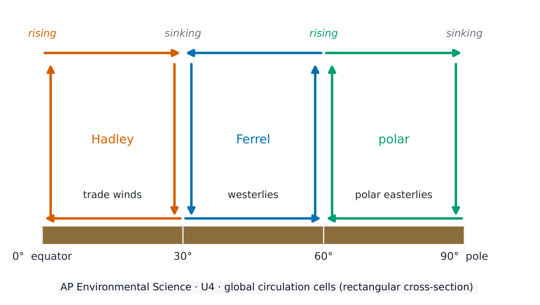
Uneven solar heating drives global wind patterns 全球风带. Warm air rises at the equator and sinks at about 30°, creating convection cells 对流环流 (Hadley, Ferrel, polar) and prevailing winds (trade winds, westerlies). The spinning Earth deflects winds – the Coriolis effect 科里奥利效应 – shaping weather and climate.
Vocabulary
Train
| English |
|---|
| global wind patterns/ˈɡləʊbl wɪnd ˈpætnz/ |
| convection cells/kənˈvekʃn selz/ |
| Coriolis effect/ˌkɒrɪˈəʊliz ɪˈfekt/ |
4.6
Watersheds
Syllabus
| Enduring Understanding | Learning Objective | Essential Knowledge |
|---|---|---|
ERT-4 | ERT-4.F |
|
Source: College Board AP Course and Exam Description
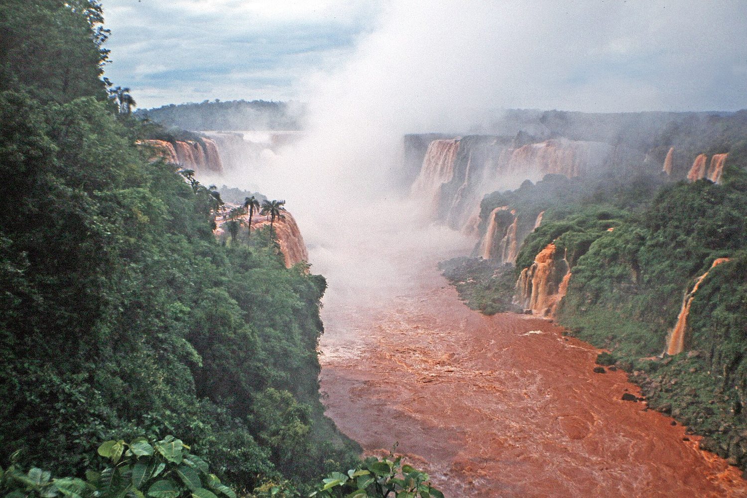
A watershed 流域 is all the land that drains to a common body of water. Everything that happens on the land – farming, paving, pollution – affects the water it drains into, so watersheds are key units for managing water quality.
Vocabulary
Train
| English |
|---|
| watershed/ˈwɔːtəʃed/ |
4.7
Solar Radiation and Earth's Seasons
Syllabus
| Enduring Understanding | Learning Objective | Essential Knowledge |
|---|---|---|
ENG-2 | ENG-2.A |
|
Source: College Board AP Course and Exam Description
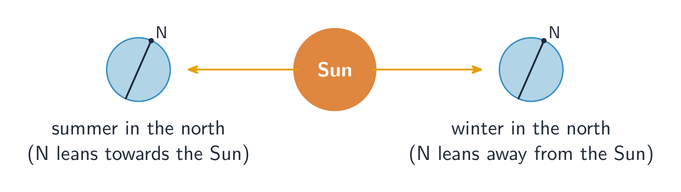
Seasons come from Earth's tilted axis (about 23.5°), not its distance from the Sun. The hemisphere tilted toward the Sun gets more direct sunlight and longer days (summer). The tilt also makes the tropics warm year-round and the poles cold.
4.8
Earth's Geography and Climate
Syllabus
| Enduring Understanding | Learning Objective | Essential Knowledge |
|---|---|---|
ENG-2 | ENG-2.B |
|
Source: College Board AP Course and Exam Description
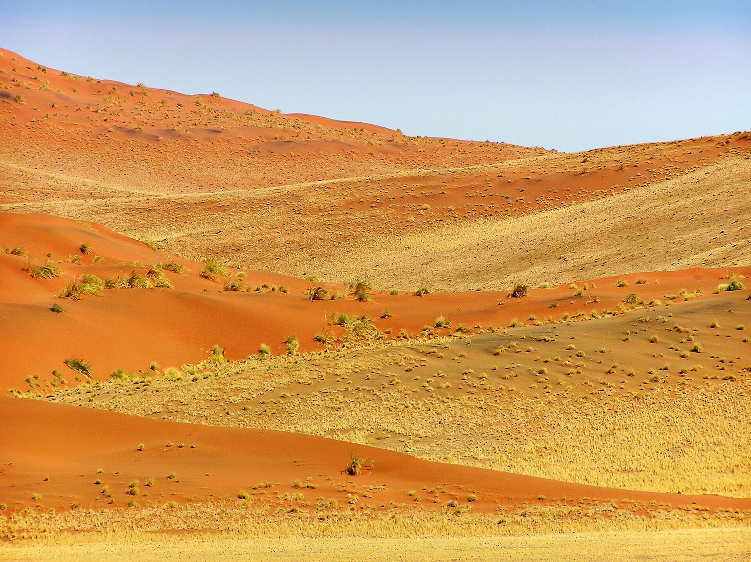
Geography shapes climate: latitude (sunlight angle), elevation (cooler with height), proximity to oceans (moderating temperature), and mountains creating a rain shadow 雨影 (wet windward side, dry leeward side). These factors decide which biome forms where.
Vocabulary
Train
| English |
|---|
| rain shadow/reɪn ˈʃædəʊ/ |
4.9
El Nino and La Nina
Syllabus
| Enduring Understanding | Learning Objective | Essential Knowledge |
|---|---|---|
ENG-2 | ENG-2.C |
|
Source: College Board AP Course and Exam Description
El Niño 厄尔尼诺 and La Niña 拉尼娜 are periodic shifts in Pacific Ocean temperatures and winds. El Niño (warm eastern Pacific) and La Niña (cool eastern Pacific) alter rainfall, storms, and fisheries worldwide – for example, floods in some regions and droughts in others.
Worked example. A tectonic plate moves 5 cm per year. How far does it travel in 1 million years? $5\ \text{cm/yr}\times 10^{6}\ \text{yr}=5\times10^{6}\ \text{cm}=50\ \text{km}$. A tiny yearly motion adds up to ocean-basin-scale distances over geologic time — the same slow rate that opens oceans and builds mountain ranges.
Vocabulary
Train
| English |
|---|
| El Niño/el ˈniːnjəʊ/ |
| La Niña/læ ˈniːnjə/ |
4.9
Exam tips
- Seasons come from the Earth's tilt, not its distance from the Sun.
- Soil forms very slowly, so erosion faster than formation permanently depletes it; know soil texture (sand/silt/clay) and horizons.
- Explain global wind patterns from uneven heating + the Coriolis effect, and a rain shadow (wet windward, dry leeward).
- Name the atmospheric layers (troposphere = weather, stratosphere = ozone) and air composition (~78% N₂, 21% O₂).
- El Niño / La Niña are Pacific temperature shifts that change rainfall worldwide.
Interactive lessons on this topic
Work through it step by step, with instant-check exercises.